(click on images to enlarge)
Author
Pastures of memories,
Sifting through life’s mysteries,
Golden cows and butterflies,
All on a summer’s day.
Another time in a land so fair,
With sacred groves in mountain air,
I’d ride my horse down a village green,
Round houses lined each side;
Where the Thunder God still reigned supreme,
And people danced upon the green;
They offered gifts to the temple priest,
And drank their honey wine.
Composed by Charlie Ipcar © 2004 (click here for MP3)
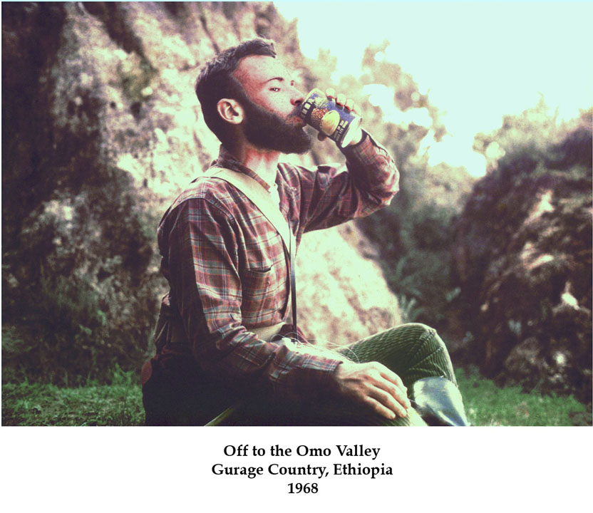
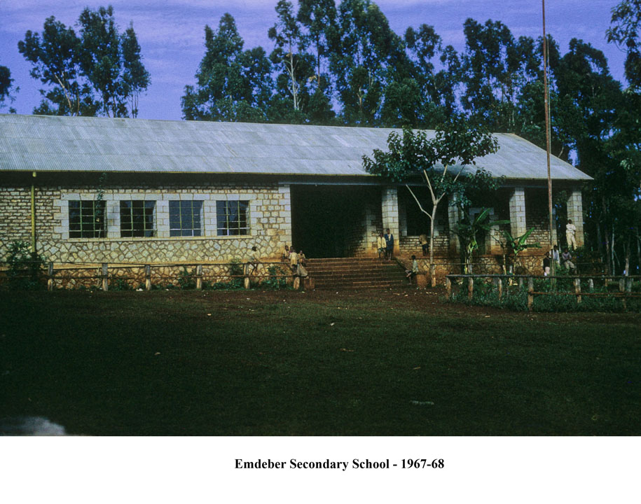
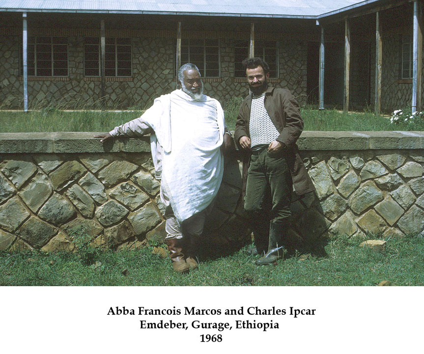
Some forty years ago I arrived in the land of Ethiopia as a Peace Corps Volunteer teacher (Ethiopia VI), a long time ago to some but almost yesterday to me. For my first two years I taught science at a technical school in Addis Ababa; it was a fine school but not my romantic idea of where I thought I'd be working in the Peace Corps. Accordingly, I extended my tour for a third year and transferred to the Emdeber Secondary School in the Gurage country.
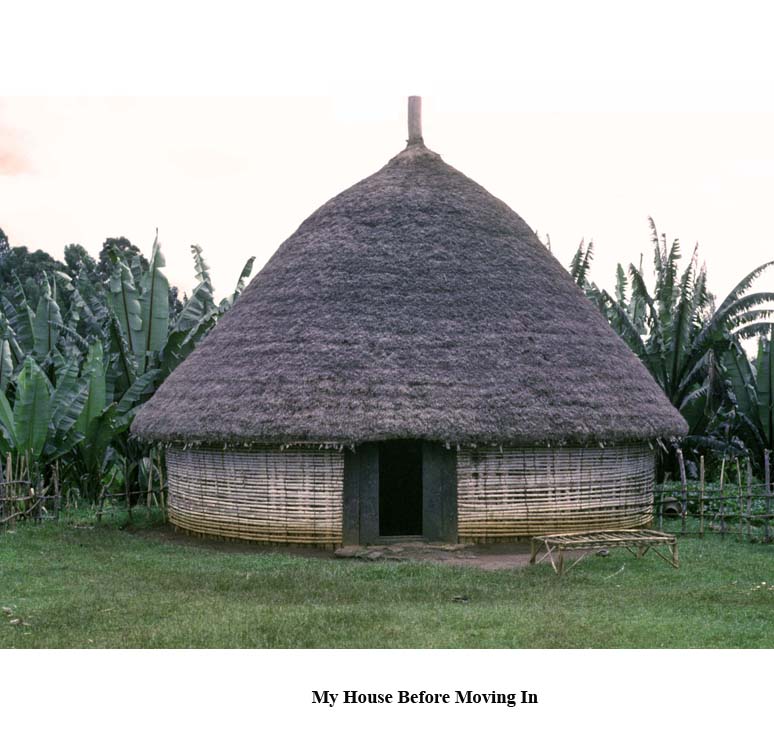
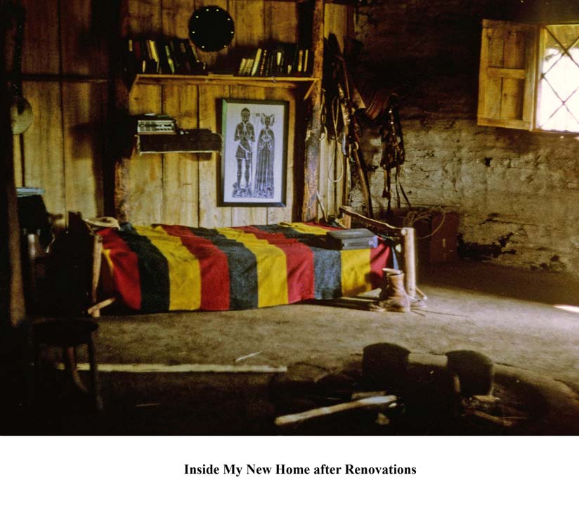
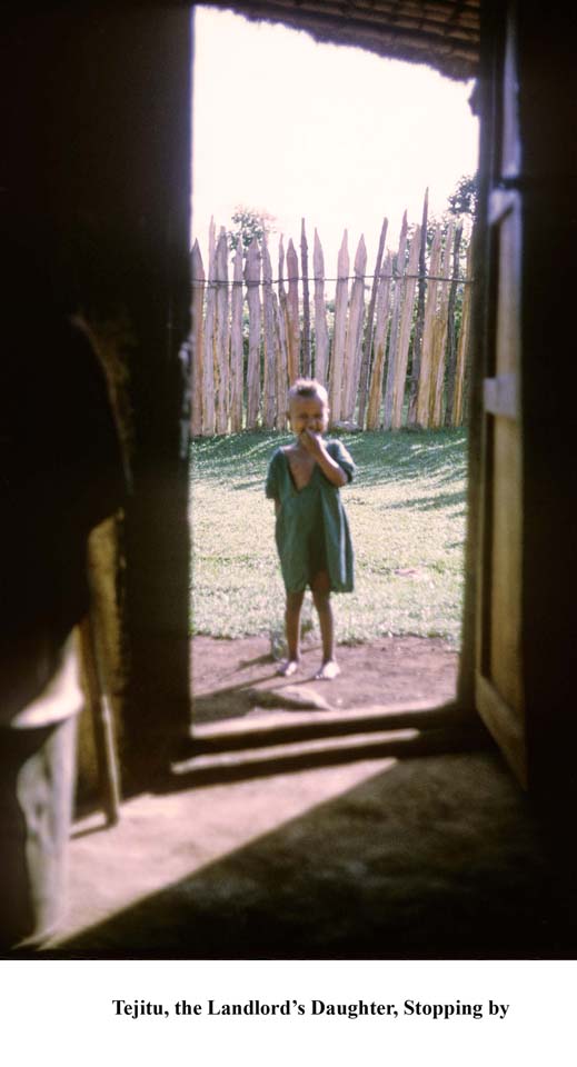
The Gurage are an ethnic group well respected for their industry and craftsmanship. My experience working with them was much closer to my original concept. I got to live in a well-constructed traditional thatched house.
I was able to purchase a horse to ride, to help explore the surrounding area. The cultural landscape was a lovely mosaic of intensive agriculture and sacred groves; the physical landscape featured ridges and valleys.

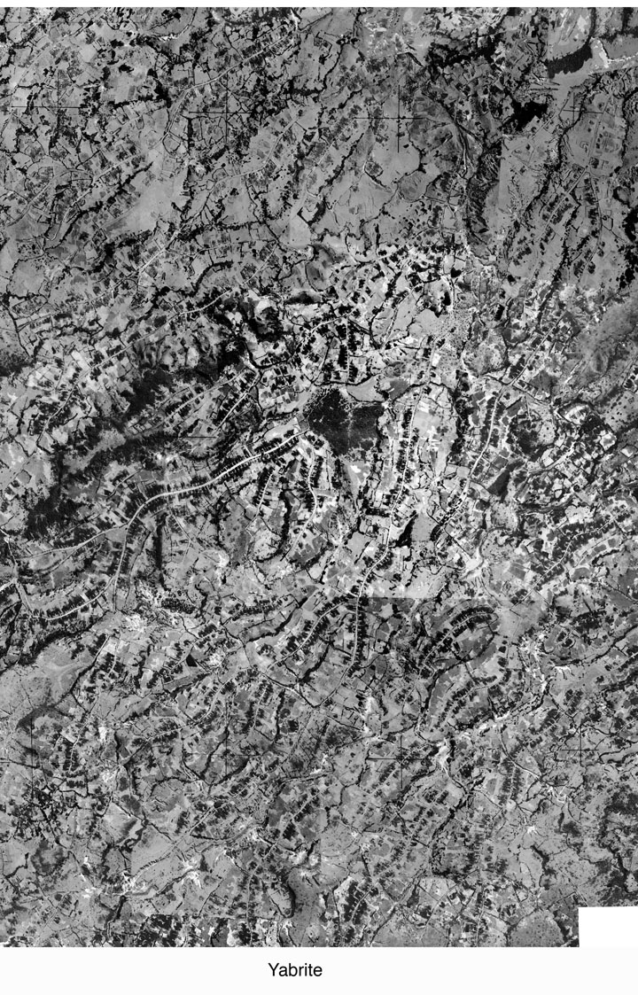
As a Geography teacher I soon got access to air photographs and used them to explain to my students the general principles of mapping, while they explained to me what was actually portrayed on the photos.
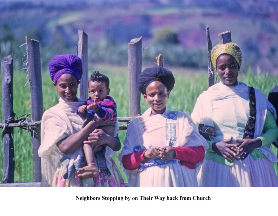
As a person who was interested in folk songs, I also got to hear a variety of traditional work songs, field songs that were used for transplanting huge false banana plants and other work songs used to help raise the center post in home construction. I was invited to attend the daily coffee breaks in the neighboring houses and got to know my neighbors on several levels.
It was a fascinating third year.
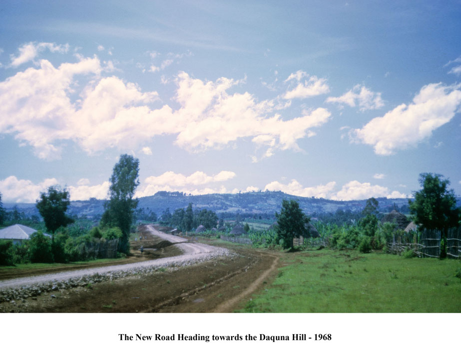
This year I learned a fellow Peace Corps teacher, Phil Lebel (Ethiopia IV), whom I worked with in Emdeber, would be in Addis Ababa this winter to teach at the University. It seemed like a good time for my revisit. I'd be able to stay at his apartment while I got re-oriented, and then we'd both go back to Emdeber where we'd been teaching. Our mission would be to find out what had happened to some of our neighbors, fellow teachers and students: the good and the sad. I also have many follow-up questions to ask about the local geography now that I've had time to process the information I accumulated while there; my master's degree (1970) was based on interpreting the Gurage cultural landscape. I'm also planning to leave a laptop computer loaded with images of my maps and the original set of air photos (1957) at the secondary school library, and provide updates if I can secure them from the Ethiopian Mapping Authority. There is now a network of all-weather roads in the Gurage area and we'd certainly like to explore them. And then there is the intriguing question of how the traditional lifestyle has changed in 40 years. I'll be keeping a travel journal and making periodic posts to this website. I should be in Ethiopia for about two weeks.
Suffice to say, I fly out of Boston February 17, change planes in Frankfurt, and land in Addis Ababa, Ethiopia, February 18. Google Earth provides a bird's eye view of Addis Ababa in great detail: search for "Addis Ababa Bole International Airport" as a start. The neighborhood that I'll be using as my base camp is located near the old airport (Lideta District) in the Northwest corner of the City (follow the "ring road" left from the airport).
I've had the usual set of shots: yellow fever, hepatitis, typhus, and a box of anti-malaria pills. I've been reviewing my Amharic vocabulary, discovering that it's easier to learn words I used to know than to learn new ones! I've got a big book of Travelers Checks, useful given that credit and debit cards are not fully operational in Ethiopia. And I have a shiny new cellphone which I'll try to load with a local chip, although it's unclear how useful that will be outside of Addis Ababa.
I've also been reviewing various travel guidebooks to Ethiopia; many more are available now than there were 40 years ago (there were none!). The best I've found is one by John Graham, ETHIOPIA: Off the Beaten Path. It compares favorably to ETHIOPIA: Hellhole of Creation, which was the only "exploration" book I was able to find before entering Peace Corps training in 1965.
The secondary school in Emdeber where we taught is located about two hours by car southwest of Addis Ababa.

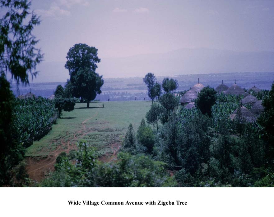
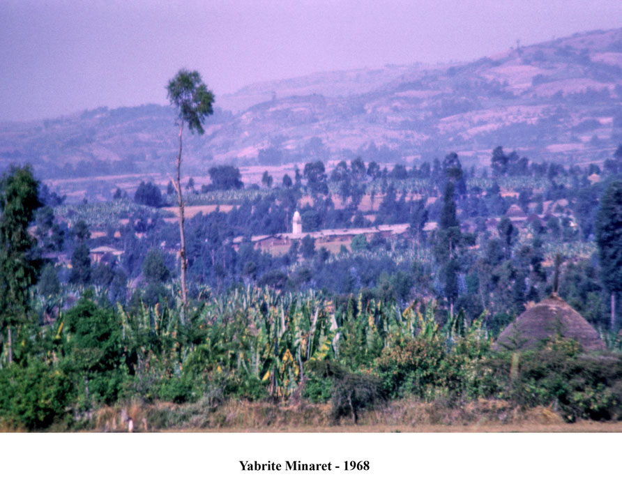
One takes the Jimma Road, all asphalt, until reaching the small market town of Wolkite (also can be viewed at high resolution via Goggle Earth). One then turns southeast on the gravel road to Emdeber, just beyond the town to the left, which takes about 30 minutes to reach; Google Earth coverage is not yet available at high resolution for much of the area I'll be re-exploring. But you can get a good impression of the Gurage cultural landscape by exploring around the outer margins of Wolkite. Emdeber (spelled as "Indibir" in the Google Earth program) is an administrative center for the Sabat-Bet Gurage (literally the Seven Houses of Gurage) and is located on a prominent ridge between the lower (the Fields of Atat) and upper plateaux (Gumer Highlands).
The major subsistence crop for the Gurage is the root of the false banana tree, enset ventricosam,

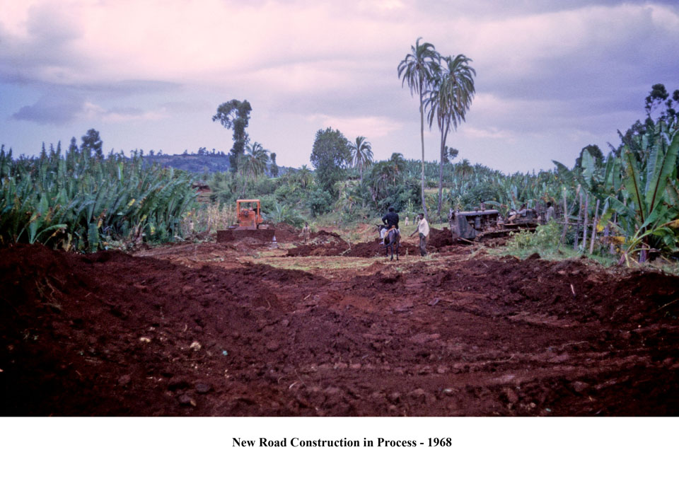
which can support an extremely high population density, averaging 300 persons per square kilometer, with villages running like ribbons along every ridge; the root is ground into a fine mash and then placed in clay vessels that are buried in the ground where the mash ferments for at least a year, the longer the better! Then, the mash is used to make a kind of bread. Cash crops include coffee and chat and some grain from the plateau areas. The entire network of roads in this area was planned and built by the Gurage regional development committee.
The furthest south we plan to go after Emdeber would be to the town of Jumborah, high on the upper plateau. To the west lies the Omo Valley, to the east the Rift Valley lakes. This time we will be traveling via rental car instead of on horseback.

Throughout the Gurage cultural region a periodic marketing system operates, with most markets operating only on a unique day of the week. A few of the larger markets like the one in Emdeber operated in a limited fashion every day of the week but expanded greatly on the "market day." There were few permanent stalls or shelters but each class of goods had its particular area of the marketplace.

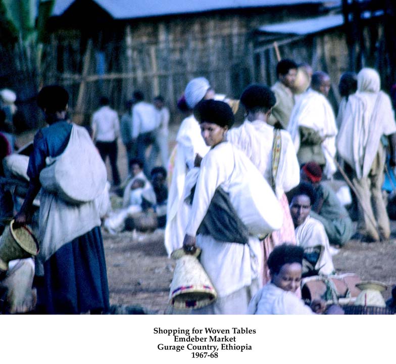
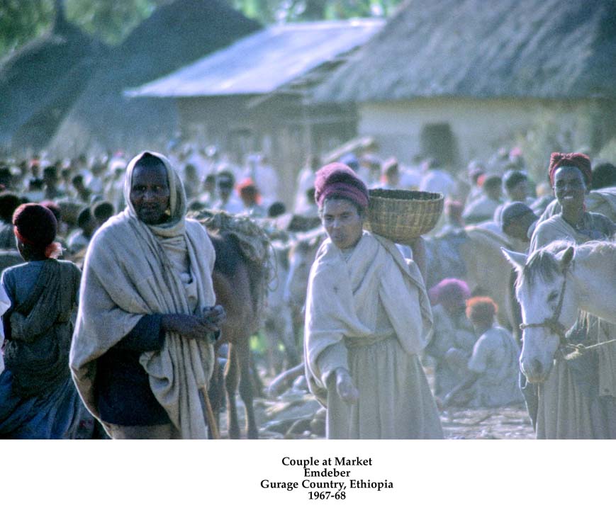
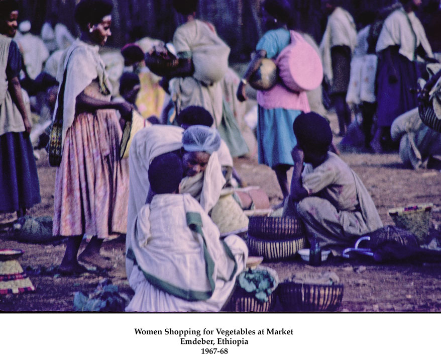
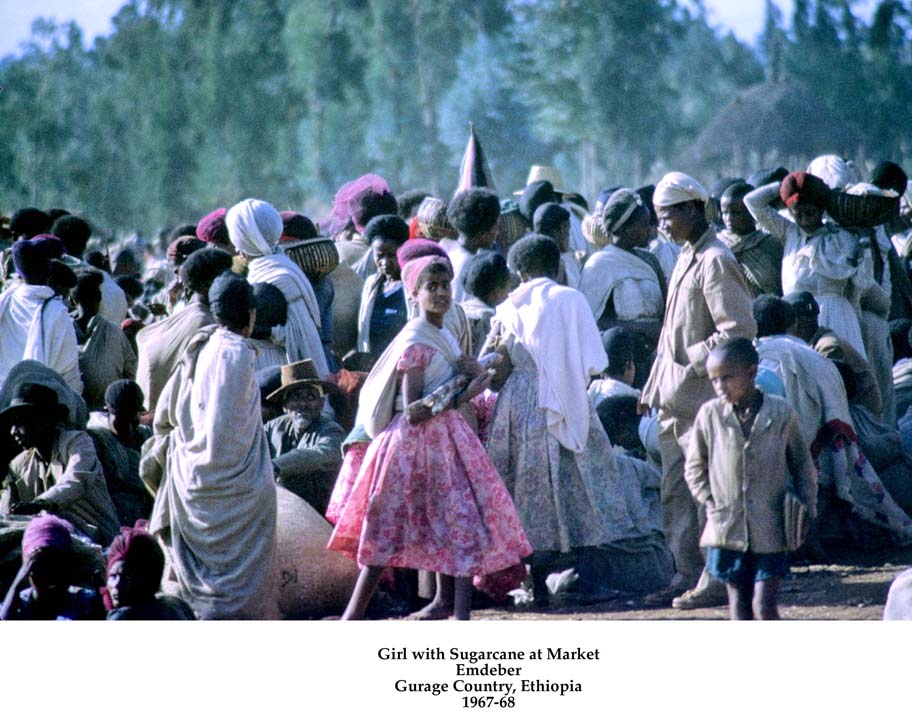
What initially appeared to be chaos to my eyes was in actually a well-organized system. Items traded included agricultural products, livestock, pottery, cloth, basketwork, cash crops such as coffee and chat, with a few exotic items from the outside world.
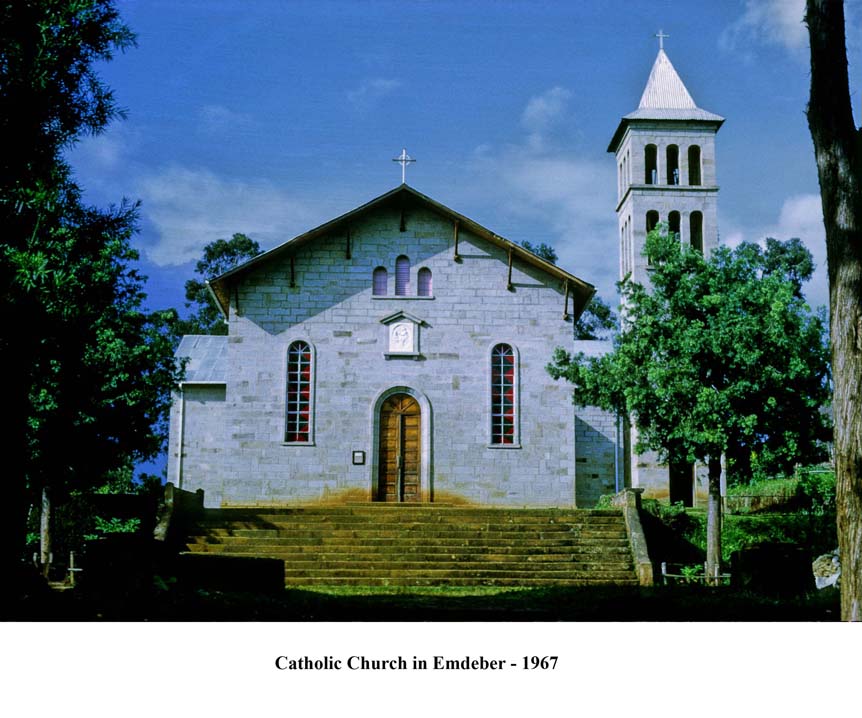
The Gurage culture is described as a combination of the Sidama culture to the south and the Amhara-Tigre culture to the north. The Gurage were independent for a hundred years or more but were conquered by the army of the Emperor Menilik II in the late 19th century, and have been part of the Ethiopian nation ever since. The religious affiliation of the Gurage is now evenly divided between the Orthodox Christians,

Moslems,
and the newer Catholic Mission.
Most Gurages when I was resident were also active participants in the various animistic cults associated with the Star God Waq and the Thunder God Boza.
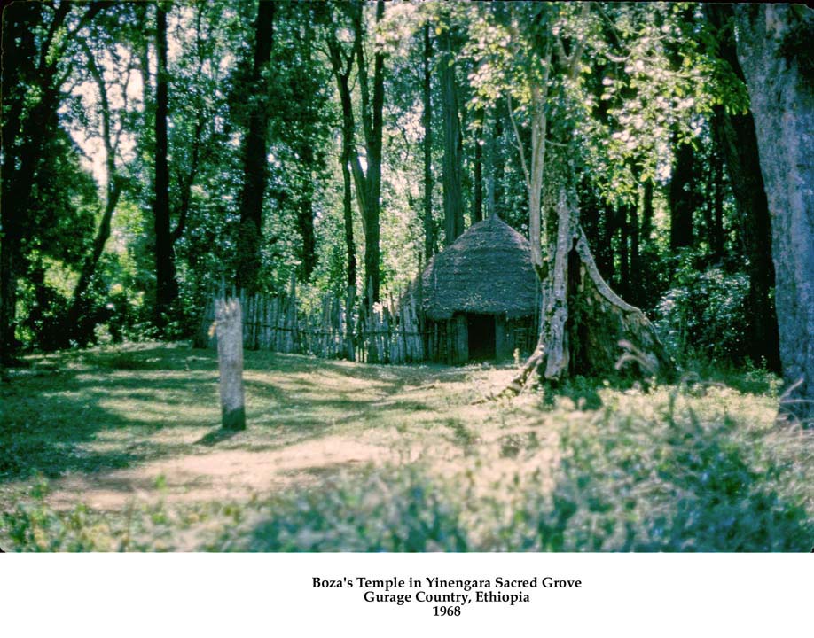
I do wonder if the Old Gods still reign.
I'm planning to make some updates to this website while I am in Ethiopia, but I'll have much more to say when I return to the States, and hopefully I'll be able to provide a full set of new images.
But now, where have the Old Gods gone?
Do the sacred groves still ring with chants and song?
Perhaps, I’ll journey once again,
Listen in the evening wind,
And pour a horn of honey wine
At the foot of some old tree.